The Neurodivergent Hiking Group
Building Social Connections on the hoof!
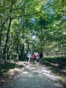
We offer guided walks for neurodivergent people and their families through the Forêt de Soignes / het Zoniënwoud, near Brussels. The walks are free, but feel free to make a donation, or become a member, or volunteer of Neurodiversity Belgium if you wish!
The regular hikes normally take place every first Sunday of the month but occasionally there are exceptions (when no guides are available, typically this can happen during the Christmas vacations). Sometimes there are extra hikes for special interests.
Sign up:
You can sign up from our Events Page or simply turn up on the day if you already know the meeting point and time.
Planned dates and routes:
Unless otherwise stated, all hikes start at 13:00 and end back at the starting point.
- 2 November— meeting at entrance to Tournay-Solvay Park, closest to tram stop Boitsfort on tram 8 and about 150m from the train station Boitsfort/Bosvoorde.
Careful! the Brussels marathon is also happening on this day. If it’s interfering with busses and you are coming from the centre of Brussels then metro line 5 to Hermann Debroux and getting tram 8 from there to Boitsfort should work fine. - 7 December — meeting at forest entrance where Rue Nisard meets Rue Buis, closest to tram stop Wiener on tram 8
- 4 January — meeting at Cloitre-Rouge parking, closest to bus 34 stop Deux Chaussées
Please don’t leave it until the day of the hike to sign up and do let us know in advance if you have any special needs.
On the day of the event itself we typically have very little time for communicating (our hyperactive selves/dogs/kids compete for our attention).
How to recognise your guide
Our regular guide is Jon. Recognisable by his glasses, pony tail and beard.
For more information: hiking@neurodiversity.be
Typical Routes/Locations
- Brussels, Watermael-Boitsfort, entrance to forest where Rue Nisard ends
From Place Wiener go up the hill of Rue Nisard. Note that the small parking area at the entrance to the forest has now been closed to cars.
Google Maps - Brussels, Watermael-Boitsfort, entrance to Tournay-Solvay Park, closest to tram stop Boitsfort on tram 8 and about 150m from the train station Boitsfort/Bosvoorde.
Photos (mostly) taken along this route: https://www.alltrails.com/trail/belgium/brussels-capital/boitsfort-parc-tournay-reserve-naturelle-des-enfants-noyes/photos
Google Maps satellite view of the meeting/ending pointHow to get there by train:
get off at Boitsfort/Bosvoorde DO NOT CONFUSE WITH STATION WATERMAEL! (the stations are about 2km apart).
When leaving the station you will find yourself on a bridge over the railway line on a fairly busy road. You need to walk in the downhill direction (follow the smaller Chausseé de la Hulpe which curves down and to the right) and you should soon see the car parking of the train station to the right. Continue about 200m downhill past the old-clothes containers at the entrance to the car park. You should then see (about 45 degrees to the left) a path with pink-red gravel, heavy black iron gates and (about 50m further) the villa which you see marked in the Google Satellite photo. We meet at the iron gates. - Brussels Auderghem: Rouge-Cloître / Rood Klooster, 1160 Auderghem
Some moderate hills. In some parts there is no GSM signal.
Restaurant on-site (about 100m from the Centre d’Art).
Google Maps (satellite view)
Apple Maps - Hoeilaart (about 5km South of Brussels): Arboretum of Groenendaal / Bosmuseum, 1560 Hoeilaart
This is about 5 minutes walk from the train/(De Lijn) bus station Groenendaal. It is in Flanders, so you get to practice your Dutch.
Free parking area along the railway line and usually there are sufficient spaces. There are possibly more parking spaces behind the bosmuseum.
Best meeting point is probably to stand roughly at the intersection of the road to the (railway line) parking and road to the Bosmuseum. Google Maps – Arboretum/Bosmuseum Groenendaal
There are some cafés/restaurants close by. 1,5 km from the small town/village of Hoeilaart. Another great place to start a walk is about 1km further along Duboislaan (starting point at the parking at Joannes Ruysbroeckweg 1 / Google Maps: Walking route Kloosterweg) but beware of muddy paths if it has been raining.
